Donner Summit abandoned train tunnels dual sport ride

This ride was organized through the Auburn Dual-Sport Meet-up group. I signed up, interested in taking this famed route, but not being familiar with the particulars of doing it. We had about 15 riders, with our staging area on the pavement of Cold Stream Road next to the Truckee Donner Lodge just south of Interstate 80. The mix of bikes ranged from 250's to GS1200's, and everything in between. Technically part was on legal pavement, but the section was so short at the beginning, some risked just bringing their green sticker bike (note that a headlight will be needed). The route was primarily dirt road with a mix of a few different more technical sections. I brought my DRZ400S on the back of a friend's pick-up truck, enabling a bit more flexibility for the terrain.
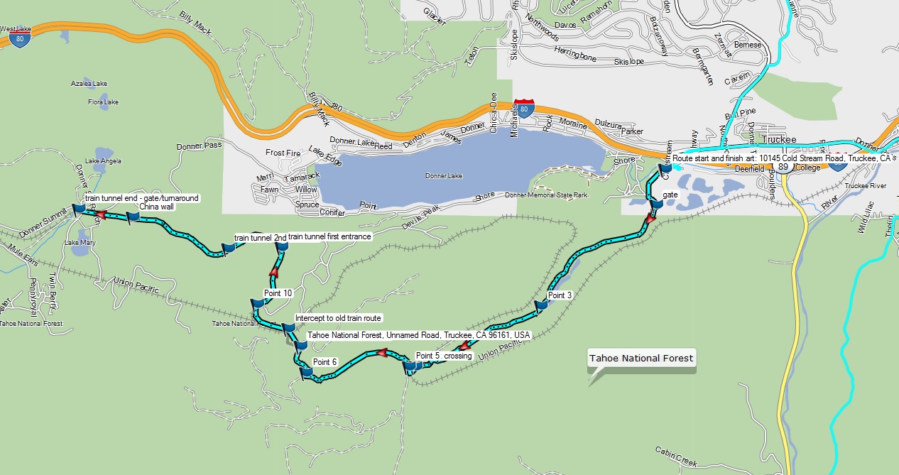
The route starts by heading west on Cold Stream Road, and then crosses under the Donner route railroad tracks through a small creek. At this point the route is dirt, and immediately after the track crossing we take the road to the right, following this for another mile. At the coordinates 39.29249, -120.29098 we take another road to the right, heading north and then east again up to Schallenberger Ridge. This ridge road is a bit more technical with looser dirt, and provides some expansive views of Donner Lake. I ended up crashing on this section when my front wheel washed out on particular downhill section with a curve at the bottom (key piece of advice: stay off the front brake on those downhill turns). Heading back down the same road from Schallenberger Ridge the key access point to the train tunnel road is via a smaller more narrow connector route at the coordinates 39.29716, -120.29196.
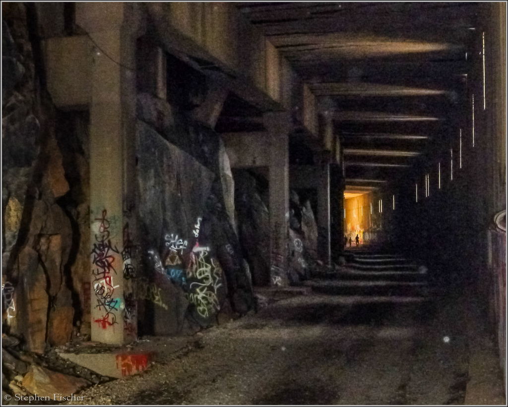
Once on the former railroad track road, you just follow this for the next 4 miles as it goes in and out of multiple train tunnels carved into the granite of Donner Summit. Trains no longer run through these tunnels, which now use a different set at a higher elevation. But these tunnels are also popular with hikers that explore them as accessed from the end at Norden, next to the Sugar Bowl ski resort. For this reason, one needs to be careful about going too fast through the darkened tunnels due to the potential hazard of others also on this road. There also tends to be water accumulated in the tunnels, so be prepared to get a little wet when going through some of the puddles, and spray from other riders.
At the end turnaround point, the road opens up again, and it is a good place for a break. It is not possible to take a four wheeled vehicle through it due to concrete barricades. But with a little creativity a dirt bike could get through here as a short cut for more direct access to the tunnels.

The KML file of the route for those that want to download it to their GPS can be found here.
On the way back from the train tunnels some of us explored some of the more technical routes to the southwest nearer to Cold Creek. This was more engaging for the dual sport bikes, and resulted in more mishaps for some riders. It is interesting to note that this terrain happens to be in the same general area where many of the famous Donner Party hit the wall in their attempt to go over the summit in heavy snow during the winter of 1847.
In summary, the ride was more unusual and a worthy experience. Although the train tunnel route was not technically difficult, some of the spur routes that we also took were more challenging. Many riders ended up crashing at some point during this ride, including myself. But none no worse for wear.
You can view a condensed video sequence of this ride on YouTube
here.
More images (click to select the larger view at bottom)


