Sweetwater Mountains dual sport ride

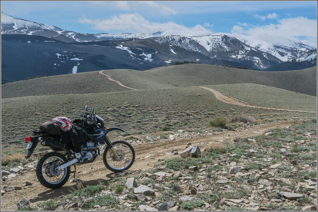
This ride starts from an ad-hoc campsite along Desert Creek near the junction with the Risue Road. I took this ride with my DRZ400S with fellow rider Randy who has the same bike (but modified for more horsepower). The bikes were hauled out here on a trailer towed behind Randy's FJ Cruise from Walker via Eastside Lane, and then Risue Road, taking about an hour from the pavement. Risue Road was muddy and rutted in some places, requiring 4wd on some of the steeper areas, helping to keep better control with the trailer on the back.
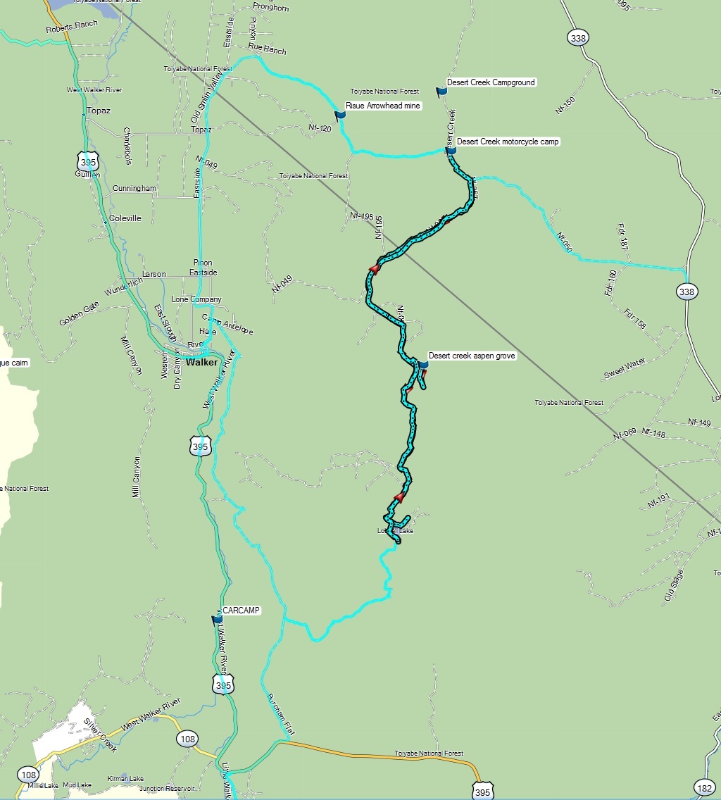
While using the camp at Desert Creek as our base, we explored different roads in the area. Following Risue Road to the east, you can reach Highway 182 on the Nevada side in about 10 miles. Getting closer to the highway, more travel trailers and folks with quads and other Razors were encountered. The most interesting riding territory seems to be on the road along Jackass Creek toward the south and up to Lobdell Lake. This later route is what is documented in the Google map below, and is a bit more technical in comparison to travel on Risue Road. A bigger adventure bike such as my F800GSA would have more difficulty due to the steep and rocky terrain in places (especially the second half), being more suited to the larger roads such as Risue and Desert Creek Roads.

The KML file of the route for those that want to download it to their GPS can be found here.
 When
we took this route at the end of May of 2016, Desert Creek was running quite
high, and the water crossing to the north seemed a bit too high to risk
crossing on the bikes. This ended up setting an agenda more toward the
south, deciding to ride up the road paralleling Jackass Creek toward Lobdell
Lake. The road had some mild flooding and erosion in places, but
passable on the DRZ400S. At about the half-way point there is a spur
trail we took down to an aspen grove back down along Desert Creek to the
east. There we also found some type of seasonable camp that looked
like a setup for dude ranch camp during the summers. Getting back on
the main trail, the road gets a bit steeper and rockier from here.
I ended up stalling out and tipping over in a rock garden in one of steepest
and most rutted sections, taking quite a bit of effort to get moving again.
It was a reminder to me of the importance for maintaining enough speed
through such sections in order to have momentum. Having a bit more
power with the bike would have helped, suffering from more doggish behavior
at altitude. Currently I have left my DRZ400S in a stock
configuration, and more riding like this may be a good incentive to do the
carb rejetting and air-box modification.
 We
ended up hitting snow shortly before Lobdell Lake, requiring some walking of
the bikes with the throttle on and helping each other push the bikes
through. After reaching the lake from the north end, we found it
easier to get around to the south by going around the west side of the lake,
with a couple of larger water crossings on the way. From Lobdell Lake
you can then connect to Burcham Flat Road, connecting you back to Highway
395 or the town of Walker. But at the end of May, the snow thwarted
this path, forcing us to double back the way we came. The return tends
to be easier, being a descent, and now more familiar with the route and what
to expect. According to my GPS, the round trip distance is 32.5
miles, with an ascent of 4500 feet, and an elapsed time of 3 hours, 10
minutes, and ride time of 2 hours, 7 minutes, with an average speed of about 15
mph.
In summary, the ride was good in terms of the scenery and amount of challenge, but not overwhelming. I would like to revisit the area in July when more of the area will be thawed out and more routes accessible, including the Belfort ghost town to the southeast, as there is much more to explore of this mountainous terrain.
You can view a condensed video sequence of the ride up from Desert Creek to
Lobdell Lake and back on YouTube
here.