GPS tracks and maps
Disclaimer: Riding a motorcycle is inherently a dangerous activity and should only be done after proper training, in a sane manner, staying on designated trails, with sufficient skills, and with appropriate safety measures. Always wear a helmet and other necessary protective gear. The author of this website disavows any responsibility of information found here, and how it is used, or the consequences from the result of it. Not all the information here may be accurate or up-to-date and is provided as-is as a public courtesy, as mistakes are possible, road and trail status may change, and thus should not be relied upon without proper cross-checking through additional sources.
Most of these rides are in California or Nevada, and all require a plated bike. The author has personally done all these rides either on a Suzuki DRZ400S dual sport, Husqvarna FE450 enduro, Husqvarna 701 enduro, or a BMW F800 GS adventure bike. The Suzuki and Husqvarna tires tend to be around 30/70 (road/dirt), while the BMW tires are about 50/50. All the tracks were captured during the rides with an Garmin Oregon 600, Zumo 395, or Montana 650T GPS. In some cases a complete track may not have been captured due to equipment malfunction or battery issues. Tracks may also reflect some mistakes (e.g. taking the wrong turn). Such errors have been edited out where found, but some may still exist.
Current number of rides listed: 52
Difficulty rating
1 - Paved, with possibility of some chip-and-seal or light gravel. Any bike
should do.
2 - Moderate amount of dirt (fire roads), may have a few ruts and/or minor water
crossings. Good for bigger adventure bikes with trail tires.
3 - More dirt w potential rock, sand, mud, or water crossings.
Dual sport preferred, but adv bike doable with 50/50 tires and reasonable skill.
4 - Lots of dirt with more technical challenges such as deep sand, steep
climbs, rockier, mud, deeper water crossings. DS highly
recommended.
5 - Very technical. Expect to crash and get your ass kicked. Rider should have advanced skills and
capable dual sport or dirt bike.
| Route Description | Map | GPX file | Notes | Difficulty |
| Alaska, Canada, including the Dempster to Tuktoyaktuk on the Arctic Sea |
|
See the GPS track list (by each day) in the summary of the Alaska-Canada blog description here | 9000 miles roundtrip over 29 days, from Sacramento CA to Tuktoyaktuk, then into popular ride locations in Alaska, and then back. See the blog on the Alask-Canada adventure ride for details | 2 ~ 3 |
| Baja 2017: border at Tecate to Cabo San Lucas and back by adventure bike |
|
See the GPS track list (by each day) in the summary of the Baja ride description here | 2000 miles roundtrip over 9 days, following more of the Pacific down, and the Sea of Cortez back up. See the blog on the Baja exploration for details | 2 ~ 3.5 |
| Baja 2023: border at Tecate to Loreto by dual sport |
|
Baja2023_day1_Tecate_to_Mikes.gpx Baja2023_day2_Mikes_to_GonzogaBay.gpx Baja2023_day3_GonzogaBay_to_GuerreroNegro.gpx Baja2023_day4_GuerreroNegro_to_SanIgnacio.gpx Baja2023_day5_SanIgnacio_to_SanJuanico.gpx Baja2023_day6_SanJuanico_to_Loreto.gpx |
800 miles over 6 days. See the video here. | 2 ~ 4 |
| Carrizo Plain loop |
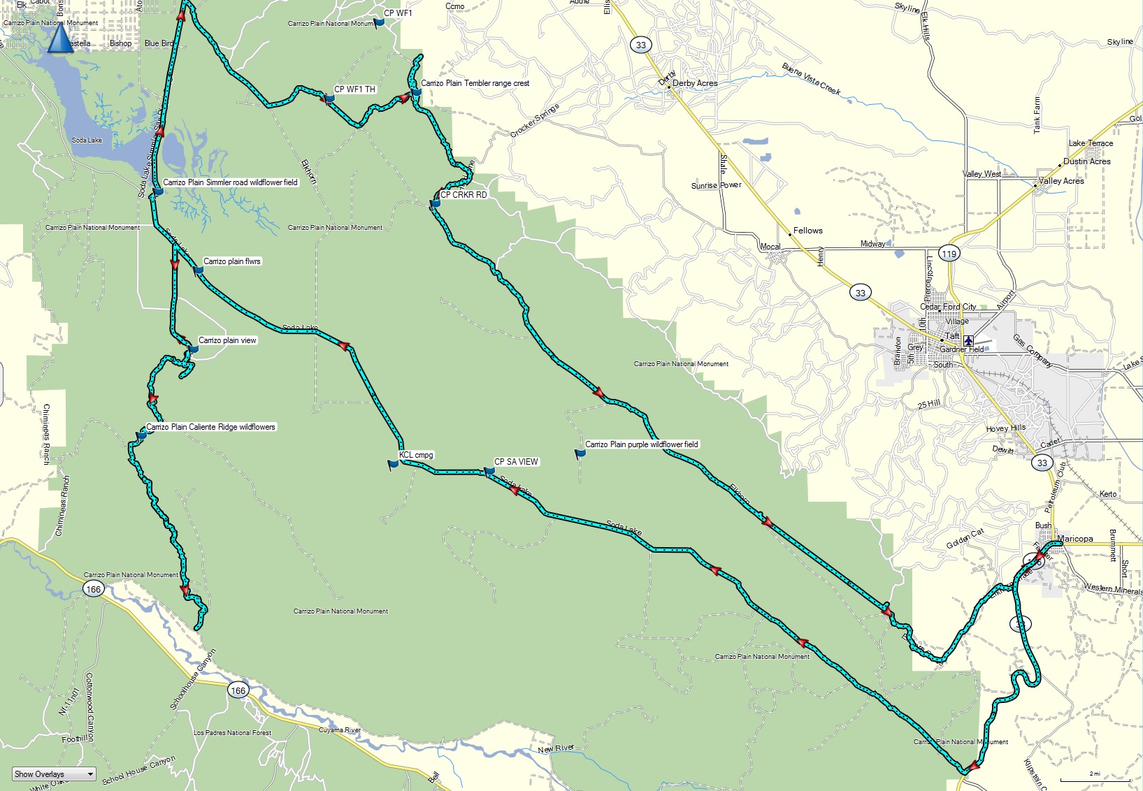 |
Carrizo Plain dual sport loop.gpx | Mostly dirt, most well graded, but some more technical climbs on the east side into the Tembler Mtns. Best done in the early spring when wildflowers are out. | 3 |
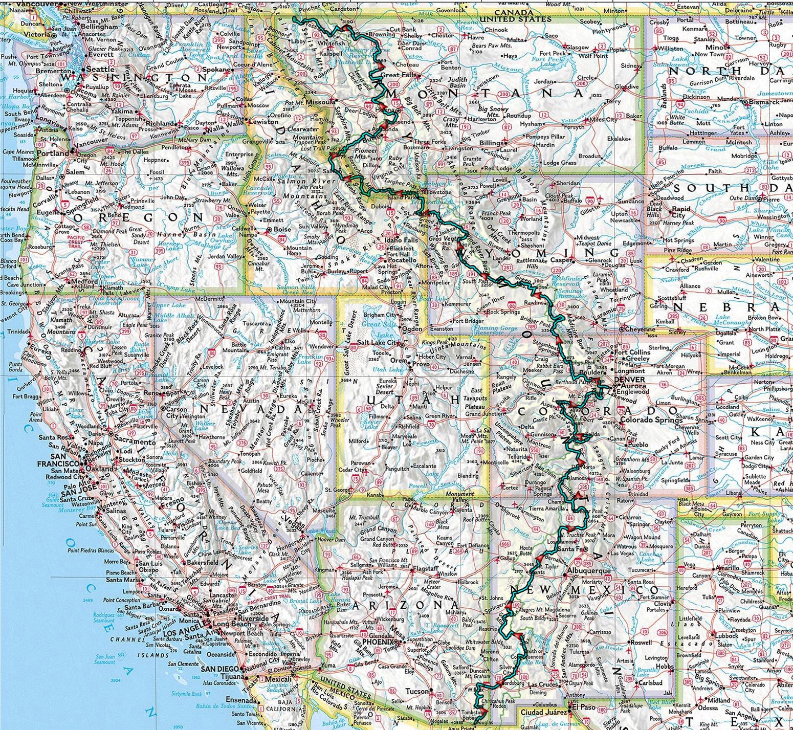
| Continental Divide Route (2017) from Mexico to Canada, traversing the states of New Mexico, Colorado, Wyoming, Idaho, and Montana. |
|
See the GPS track list (by each day) in the summary of the CDR ride description here | 3000 miles following the spine of the Continental Divide from Mexico to Canada, about 80-90% off road. See the blog on the Great Continental Divide ride for details | 2 ~ 3.5 |
| Continental Divide Route 2025 |
 |
CDR2025_day01.gpx CDR2025_day02.gpx CDR2025_day03.gpx CDR2025_day04.gpx CDR2025_day05.gpx CDR2025_day06.gpx CDR2025_day07.gpx CDR2025_day08.gpx CDR2025_day09.gpx CDR2025_day10.gpx CDR2025_day11.gpx CDR2025_day12.gpx CDR2025_day13.gpx CDR2025_day14.gpx CDR2025_day15.gpx CDR_day01_plan_CDT_off90_TyronMine.gpx CDR_day01_plan_Chirachua NM to Lordsburg backway.gpx CDR_day01_recommend_I10_to_90.gpx CDR_day04_recommend.gpx CDR_day04_recommend_Cubu_to_Abiquiu.gpx CDR_day05_recommend.gpx |
Repeat of the Continental Divide route in 2025 on my Husqvarna 701. See the video here. The tracks for some days of the ride had to be abbreviated due to weather or limitations with other riders. The 'recommend' tracks represent the desired alternatives. | 2 ~ 3.5 |
| Coyote Flat out of Bishop |
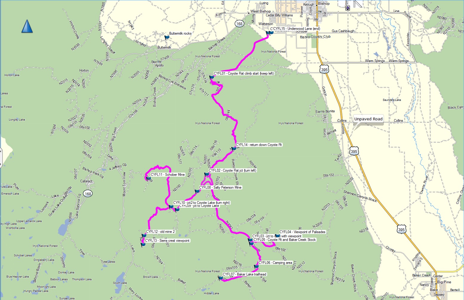 |
CYFL - Coyote Flat out of Bishop dual sport route.gpx | Long stretches of deep sand on flat, and relatively steep initial switchback climb with deep ruts. See day 5 of the Eastern Sierra ride blog for details. | 4 |
| Cache Creek, Bear Valley, Indian Valley, Upper Clear Lake, and Lake Pillsbury |
|
Cache Creek Casino, Bear Valley, Indian Valley, Upper Lake, Lake Pillbury loop.gpx | Few minor rutted sections near approach to Indian Valley. General store at Lake Pillsbury makes a good turn-around point. | 2 |
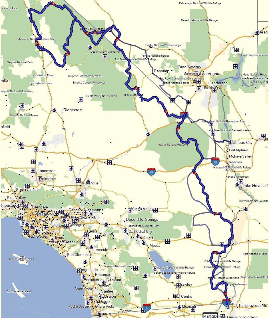
| California BDR (partial & modified) from Beatty to Yuma in 4 days |
 |
CABDR_mod track day1.gpx, CABDR_mod track day 2.gpx, CABDR_mod track day 3.gpx, CABDR_mod track day 4.1.gpx |
Epic adapted version of the California BDR from north to south starting in Beatty and ending in Yuma. Some tougher sections not found on the normal BDR not recommended for bigger adventure bikes. See the video here. | 3.5 |
| Colorado BDR from Cortez to Meeker in 5 days |
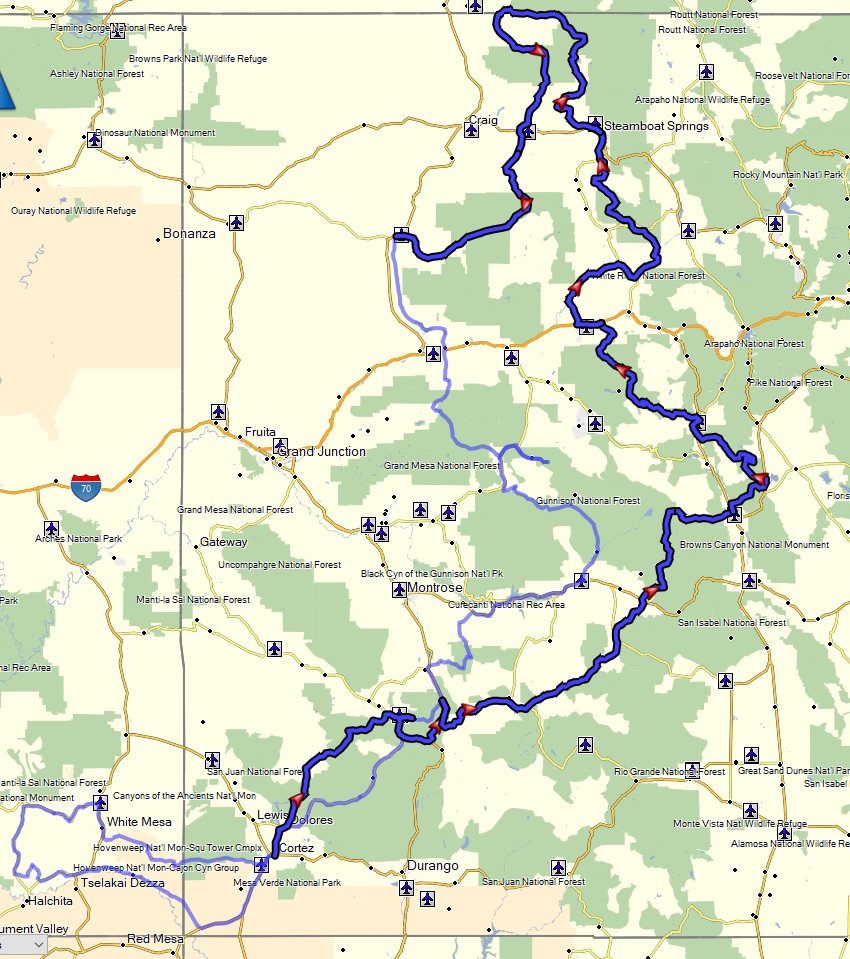 |
COBDR_day1 - Cortez to Ouray.gpx COBDR_day2 - Ouray to Buena Vista.gpx COBDR_day3 - Buena Vista to Eagle.gpx COBDR_day4 - Eagle to Steamboat Springs.gpx COBDR_day5 - Steamboat Springs to Meeker.gpx |
One of the most scenic BDRs of the west. Doable on a big bike for more experienced riders, but more fun on a dual sport. Some of the rocky passes and mud when it is raining can create some challenges. Video here. | 3.5 |
| Death Valley: Eureka Dunes, Steel Pass, Saline Valley hot springs loop |
|
Eureka Dunes - Steel Pass - Saline Valley hot springs loop.gpx | Excellent dual sport ride. Mix of some sand, rocky ledges, loose rock in washes, fast dirt roads. Great stop to soak at the hot springs. | 3.5 |
| Death Valley: Panamint Springs to Darwin and back via 4wd backroad |
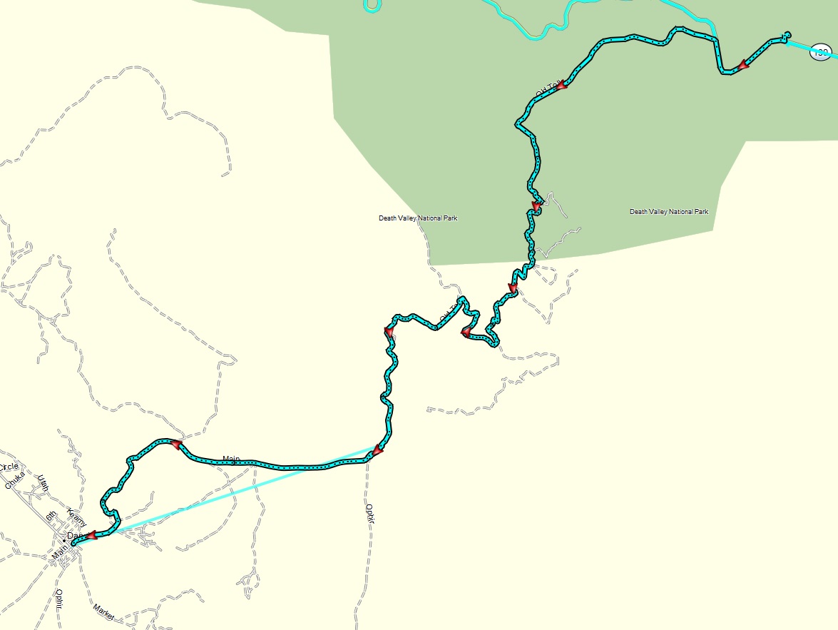 |
Panamint Springs to Darwin 2018.gpx | Good diversity of terrain from some rocky slopes, sand, and washes. Interesting remote town to explore. | 3 |
| Death Valley: Panamint Springs to Saline Hot Springs via Hunter Pass, Racetrack, and Lippencott Pass |
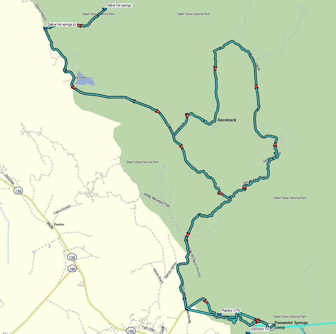 |
Panamint Springs - Hunter Pass - Racetrack - Lippencott - Saline Valley Hot spring loop.gpx | Most technical section on Lippencott Pass. Epic washboard on the Racetrack road is the ultimate torture test. See day 2 of the DV Panamint Springs ride blog for details. | 3.5 |
| Death Valley: Panamint Springs to via Goler Canyon to Barker Ranch, then over Mengel Pass down to Bad Water via Westside road to Furnace Creek, then rtn via pavement |
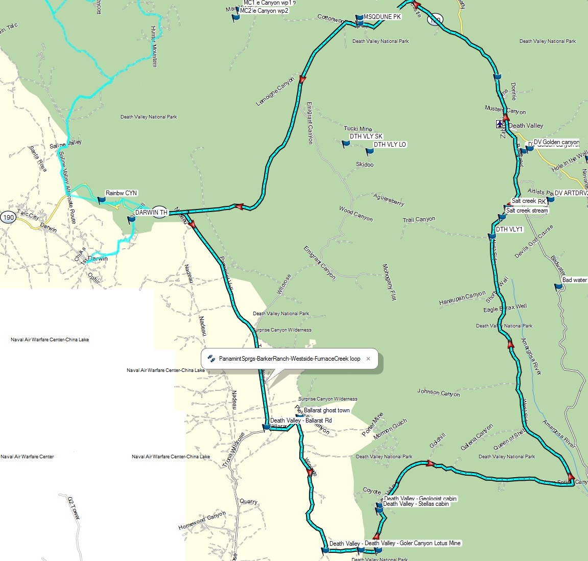 |
PanamintSprgs-BarkerRanch-Westside-FurnaceCreek loop.gpx | Technical sections on Mengel Pass, plus many sections of loose sand. More of a '3' up to Barker Ranch (Charles Manson's last holdout). See the day 1 of the DV Panamint Springs ride blog for details. | 3.5 |
| Death Valley: Ridgecrest to Pahrump via Trona Pinnacles, Goler Canyon, Ibex Dunes, playa |
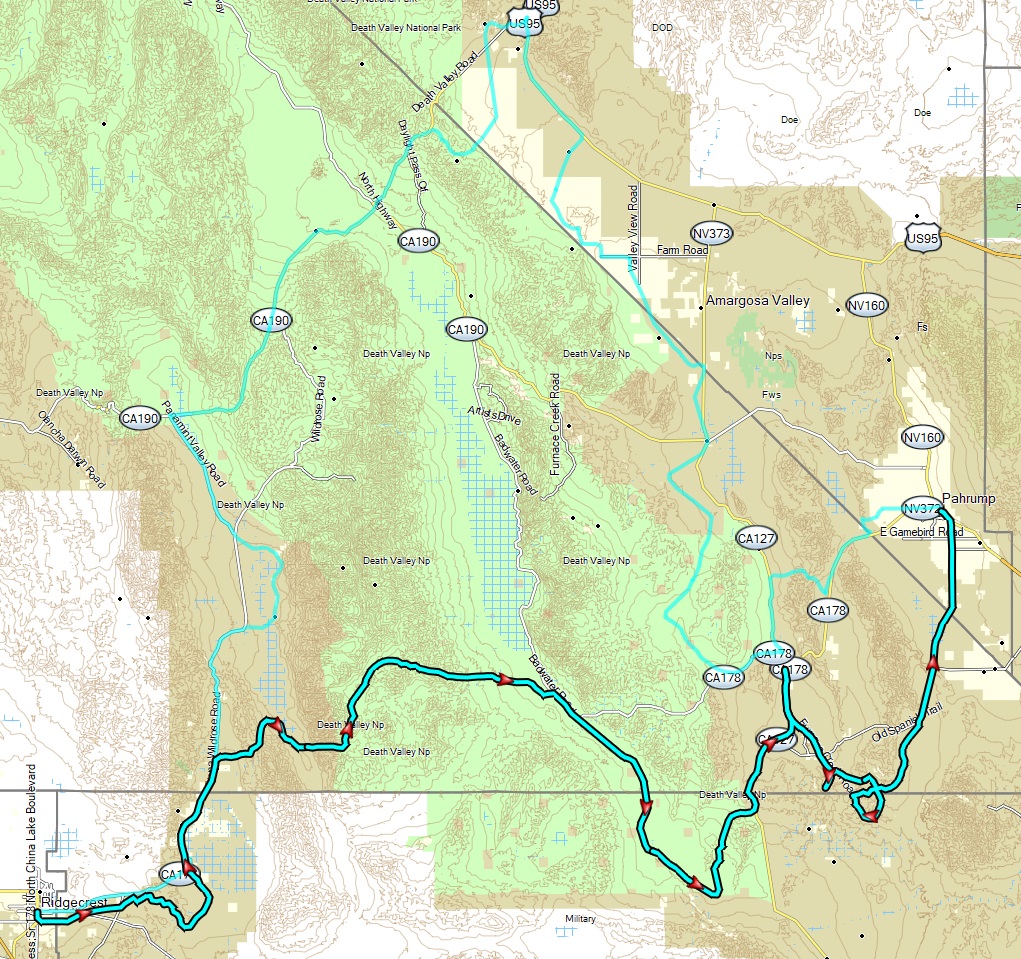 |
DV 2024-01 - Ridgecrest to Pahrump.gpx | Epic: Mix of very rocky terrain, some steep sections, ruts, sand, washes, fast dirt. See the video here | 3.5 |
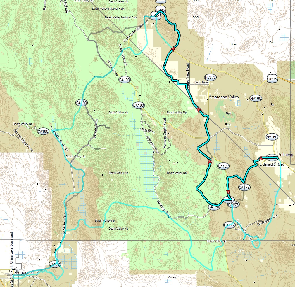
| Death Valley: Pahrump to Beatty via Shoshone, Deadman pass, Amargosa, backway into Beatty |
 |
DV 2021-02 - Pahrump to Beatty.gpx | Mix of very rocky terrain, some steep sections, ruts, sand, washes, fast dirt (harder single track option is skipped). | 3.5 |
| Death Valley: Pahrump to Beatty via single track, Deadman pass, Amargosa, Beatty |
 |
DV Pahrump to Beatty w singletrack.gpx | Mix of even more rocky terrain, some steep sections, ruts, sand, washes, fast dirt with harder single track option | 4 |
| Death Valley: Beatty to Ridgecrest via Titus Canyon, Wildrose, Auggeberry Point, Ballarat, Trona |
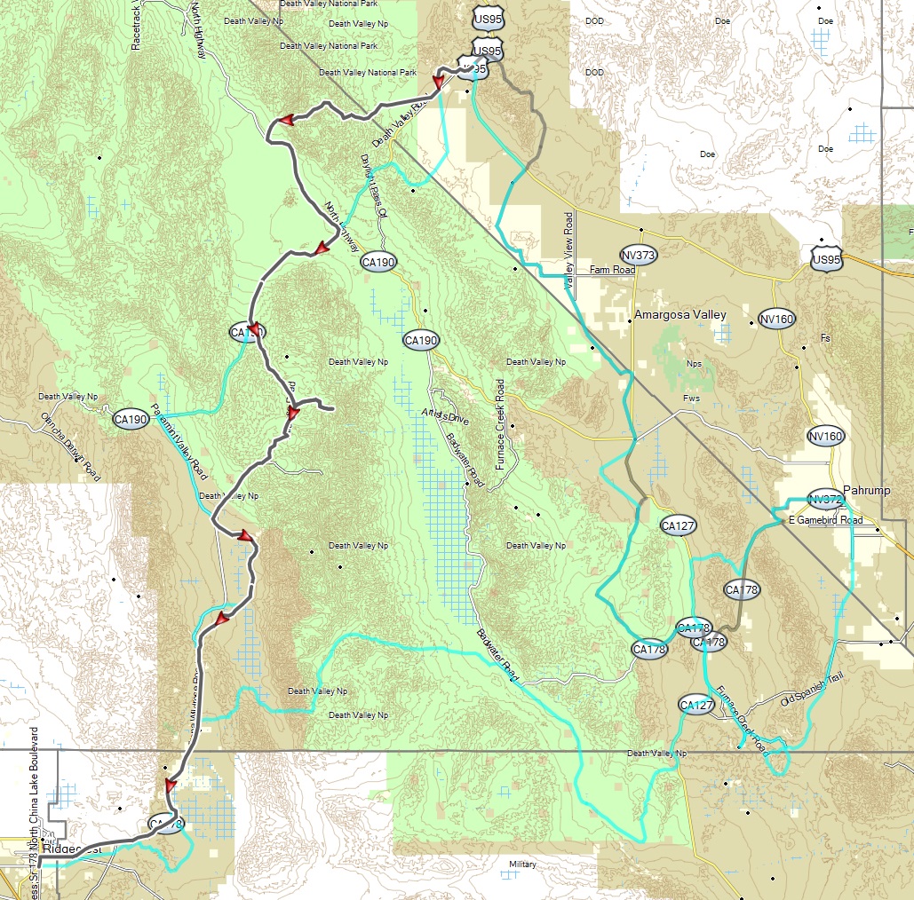 |
DV 2021-02 - Beatty to Ridgecrest via Titus.gpx | Mix of rocky terrain, sandy washes, fast dirt. See the video here | 3 |
| Donner Pass train tunnels |
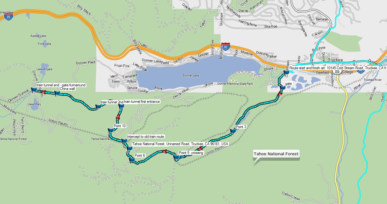 |
Donner Summit train tunnel dual sport track.gpx | Loose sections on approach to
train tunnel road, otherwise it is a '2'. See the blog for details. Note: Heard this route may no longer be legal for motorcycles? |
3 |
| Downieville to Quincy via Poker Flat and LaPorte |
|
Downieville to Quincy via LaPorte dual sport route.gpx | Dirt from Downieville to LaPorte, then paved to Quincy. Very hard climb out of Canyon Creek ravine from Poker Flat makes it a 5 (better have other riders to help), otherwise the dirt is mostly a 3. Water crossing can be deep. | 4.5 |
| Ebbetts Pass to Bear Trap Wilderness |
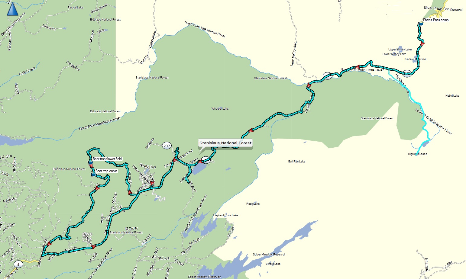 |
Ebetts Pass - Bear Trap ride.gpx | Mix of pavement on Highway 4 and more technical dirt in the Bear Trap wilderness. Later contains lots of rocky, loose and steep climbs. | 2/4 |
| Folsom - Amador county foothills ride |
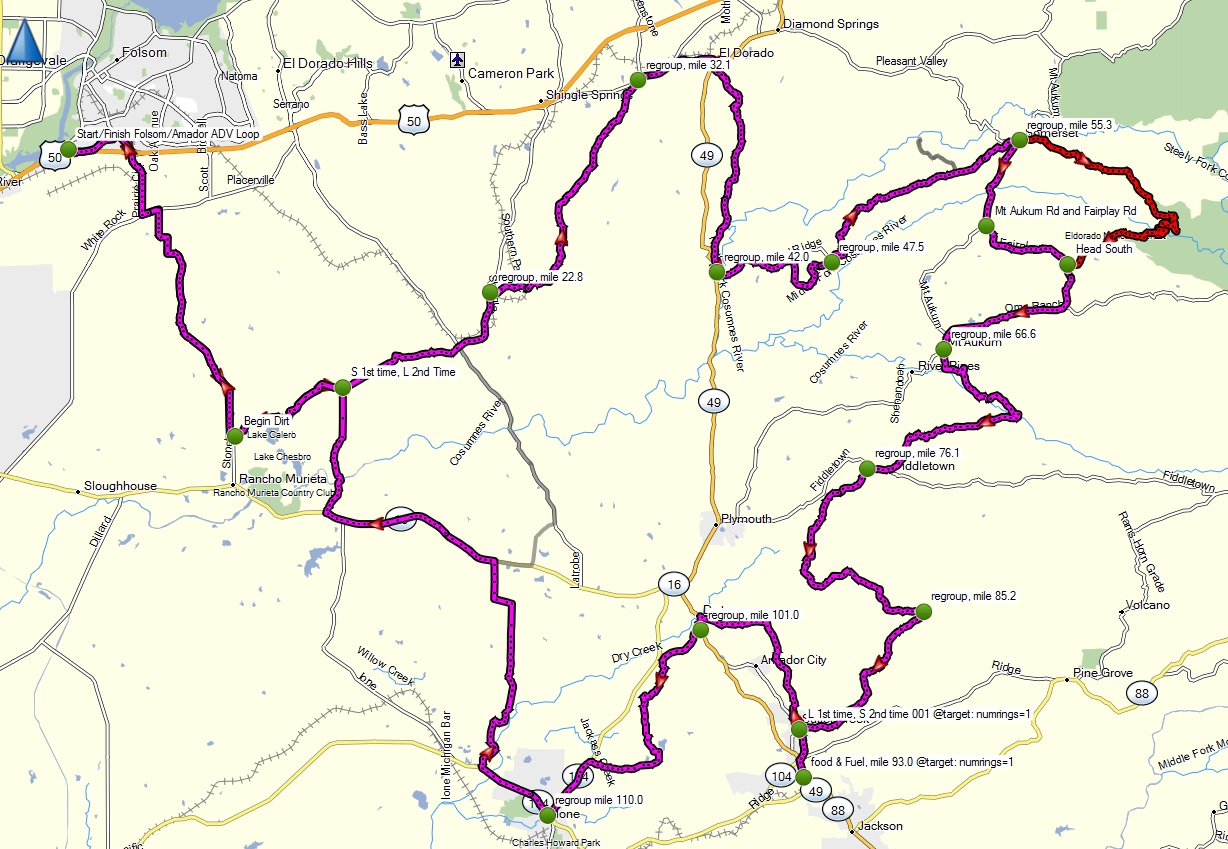 |
Folsom-Amador_foothills_ADV_ride.gpx | Good mix of dirt, scenery, and twisty backroads. Some seasonal water crossings on dirt between Scott and Latrobe. Slightly harder rutted canyon section past Somerset | 2-3 |
| Folsom to Fiddletown, Ione, Sutter Creek, Michigan Bar loop |
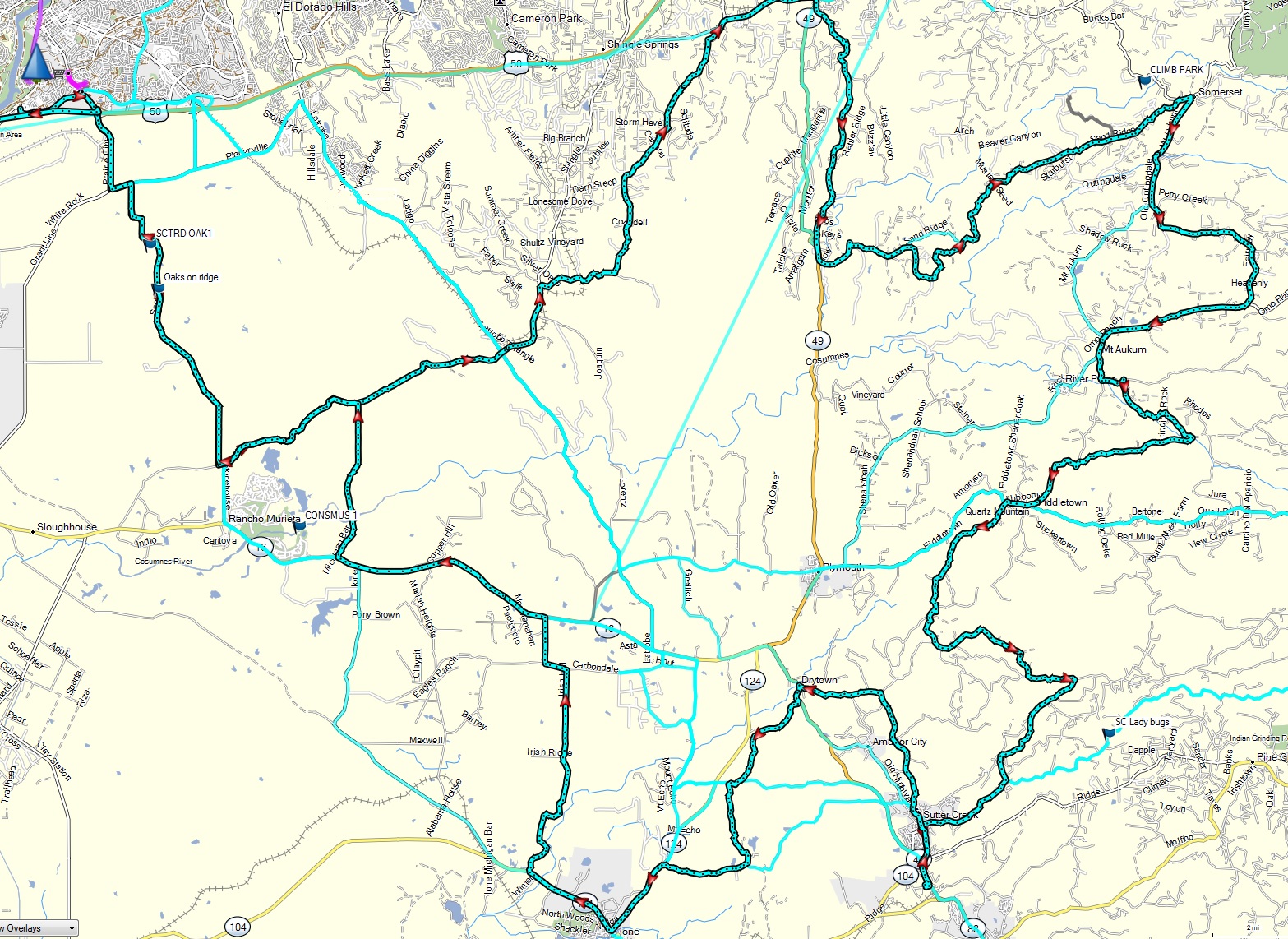 |
Folsom ElDorado Somerset Fiddletown SutterCrk Ione MichiganBar.gpx | Nice scenic foothill ride out of Folsom. Trickest section are some seasonal water crossings on dirt between Scott Road and Latrobe and Michigan Bar, plus some mud east of Michigan Bar. Otherwise mostly paved w minor water crossings. | 2 |
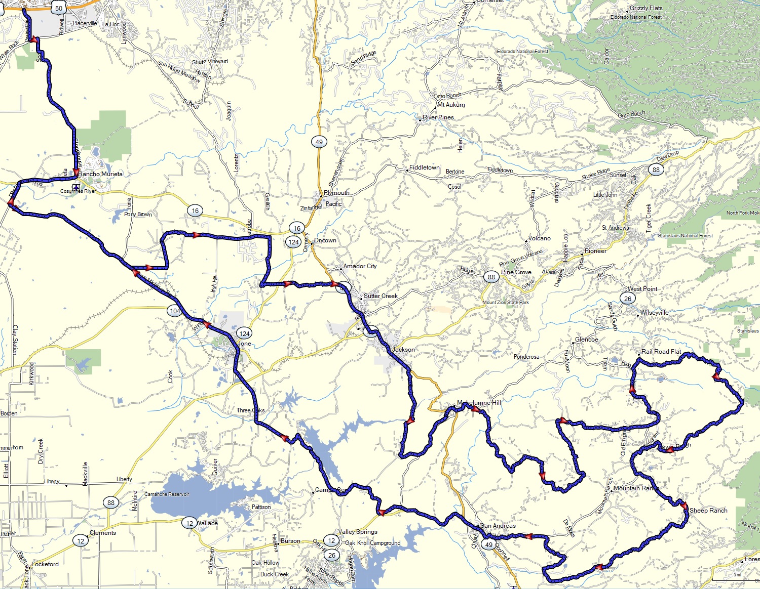
| Folsom to Mokelumne Hill to Murphys loop via backroads |
 |
Folsom Ione PardeeLake MokelumneHill SheepRanch Murphys loop.gpx | Mostly paved except for dirt from Sheep Ranch to Murphys. Can have some mud or sand depending on season. | 2 |
| Folsom, El Dorado, Amador, Calaveras loop with more dirt |
 |
ElDorado_Amador_Calaveras_loop_ride 2022-03.gpx | More dirt intensive version of the previous ride also covering Sheep Ranch and Summit Level roads. | 3 |
| Foresthill - Colfax - Iowa Hill - Sugar Pine loop |
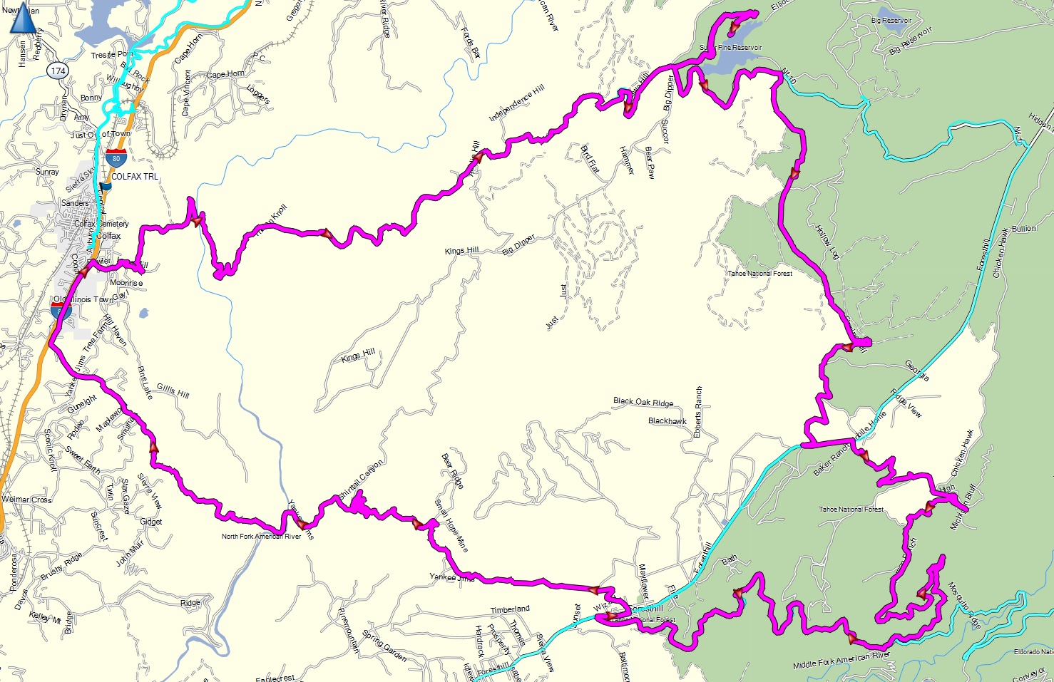 |
Foresthill - Iowa Hill dual sport loop.gpx | Dirt on Yankee Jim from ForestHill to Colfax, and from Sugar Pine back to Foresthill Road. Can have some rocks in places, but otherwise fairly smooth. Nice twisty climb up Iowa Hill from the north fork. See the blog for details. | 2 |
| Foresthill - Mosquito Ridge road - Robinson Flat - Soda Springs - Nevada City loop |
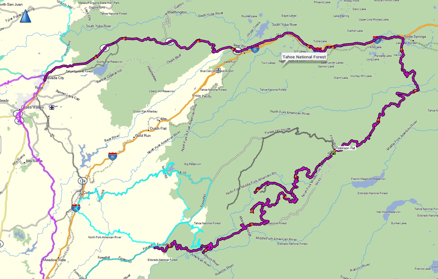 |
Foresthill MosquitoRidge RobinsonFlat SodaSprings loop.gpx | Foresthill down Mosquito Ridge (twisty asphalt), Robinson Flat and Soda Springs via dirt/rocky trail (few steep sections & water crossings), then back to Nevada City on highway 40 and 20. Good adventure bike challenge. | 3 |
| Gardnerville - Diamond Valley - Indian Creek - Monitor Pass backroads |
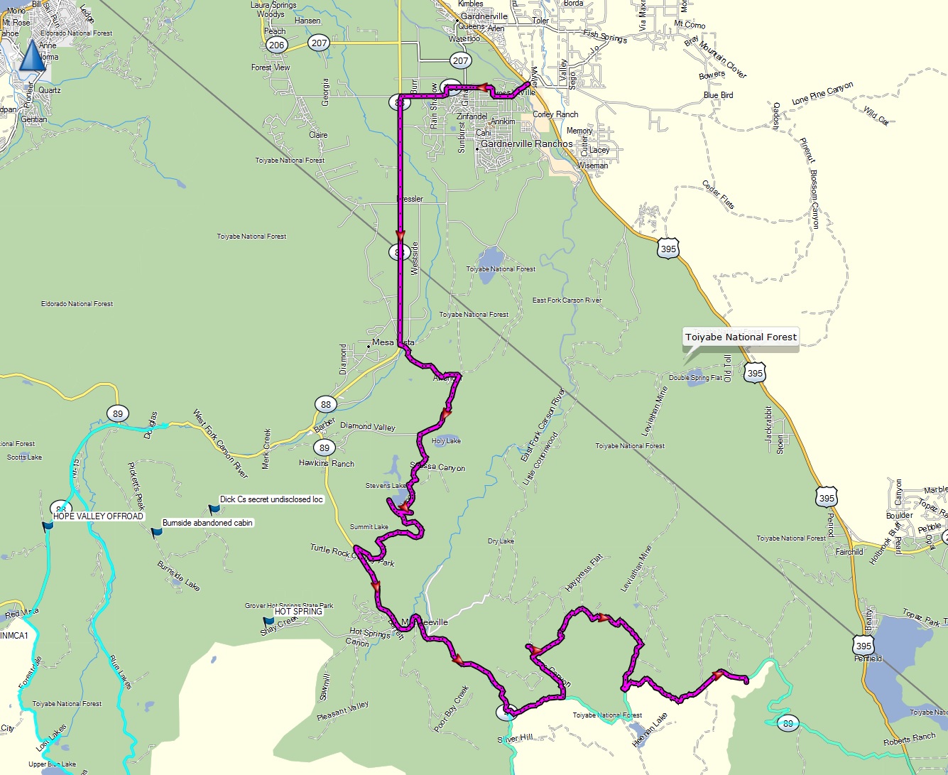 |
Gardnerville - Diamond Valley - Indian Creek - Monitor Pass backroads dual sport.gpx | Most challenging dirt and large loose rock on Monitor Pass backroad turn up due to previous forest fire, otherwise this is a '2'. | 3 |
| Georgetown - French Meadows - Foresthill backroad |
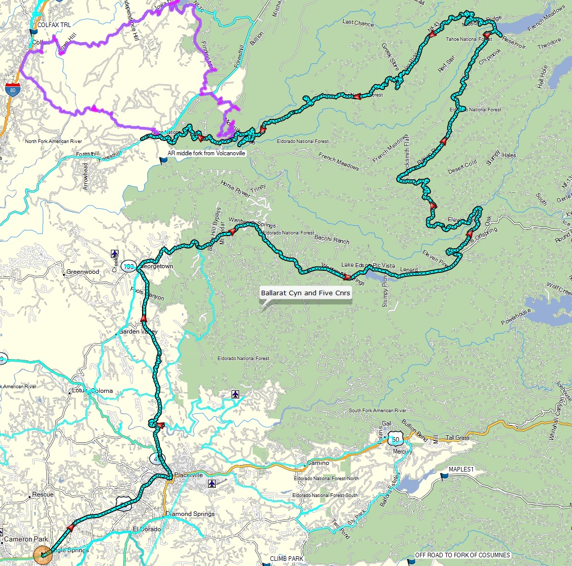 |
Georgetown - French Meadows - Foresthill loop.gpx | Mostly paved, with a few rough
sections between Wentworth Springs and French Meadows |
1.5 |
| Hope Valley - Red Lake to Blue Lakes over Red Pass, and then back as a loop |
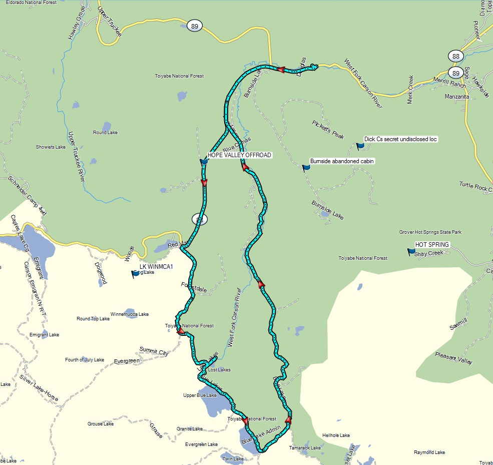 |
Hope Valley - Red Pass - Blue Lakes loop.gpx | Rocky sections over Red Pass and descent into the Blue Lakes basin. | 3.5 |
| Lockhart Basin from Moab, Utah to the Needles Outpost in the Canyonlands |
|
Lockhart Basin north to south.gpx | Epic scenery, with countless steep and rocky sections, with some sand. Rated for experts riders only. Alternate leg of the Utah BDR. Agile dual sports only. Should only be taken with other riders to help get the bikes thru. Video here. | 4.5 |
| Mono Craters backroads via Taylor Canyon |
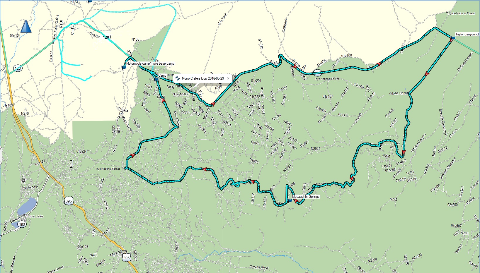 |
Mono Craters loop.gpx | Sections of very loose volcanic ash, akin to coarse sand. Some fun sections with sweeping turns on big berms of loose ash. Best done on a dual sport. | 3.5 |
| Morrison Divide trail off the Colorado BDR |
|
CO_Morrison_Divide_trail.gpx | A more difficult 13 mile tributary loop off the Colorado BDR. More suitable for a dual sport due to the more single track nature, steepness, and mud on this trail. See the video here. | 4 |
| Nevada City to Downieville via Malakoff Diggins, Alleghany, and Galloway street |
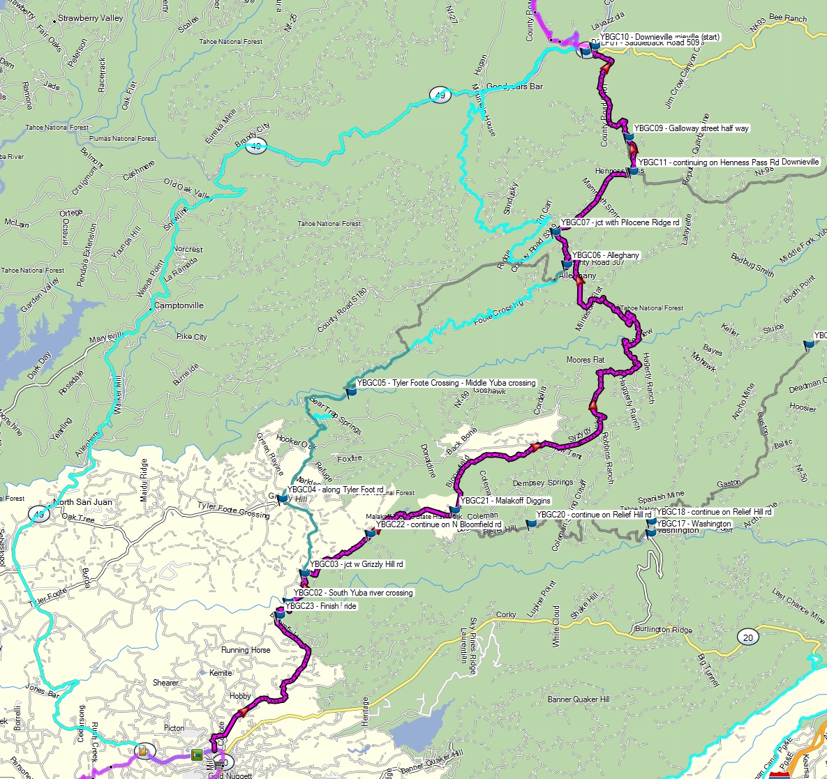 |
Yuba River Nevada City to Downieville.gpx | Lots of dirt with a few rougher sections. Steep descent on looser dirt to Downieville on Galloway street. | 3.5 |
| Nevada City - Downieville - Jackson Meadows - Washington Loop |
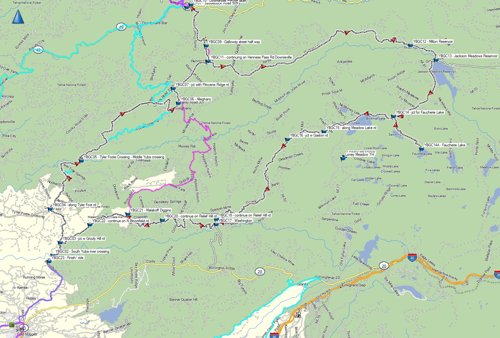 |
YBGC - Yuba River gold country loop from Nevada City to Downieville and back.gpx | Long ride: Lots of technical sections with babyhead sized boulder fields between Jackson Meadows and Washington. See the Nevada City - Downieville ride blog for details. | 4 |
| Nevada City to Downieville via Mountain House and Goodyear Bar, then up to the Saddleback mtn fire lookout, return on highway via 49 |
|
NevadaCity Downieville Saddleback loop.gpx | Mountain House+Goodyear Bar route from Nevada City to Downieville, but Tyler Foote Crossing can be rocky and rutted near Yuba middle fork. | 3.5 |
| Nevada City, Alleghany, Downieville, Sierra Buttes, Bassetts loop via Galloway steet out and Mountain House and Goodyear Bar on the return |
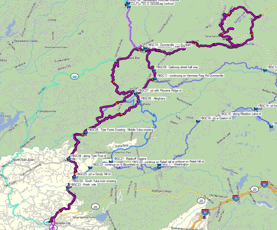 |
NevadaCity-Alleganey-Downieville-SierraButtes-Bassetts-loop2.gpx | More technical version of the previous descending very steep Galloway street into Downieville and looping out to the epic rocky Sierra Buttes lookout climb, then return via Mountain House. | 4 |
| North Coast 1: Leggett to Sinkyone, Shelter Cove, Kings Range, back down PCH to Salt Point |
|
North Coast - Leggett to Sinkyone, Shelter Cove, along the PCH to Salt Point.gpx | Mix of pavement and well graded dirt. Most rutted sections along Usal Road and Kings Peak Road. Better suited for a bigger adventure bike than North Coast 2. | 2.5 |
| North Coast 2: Fort Bragg to Sinkyone (Lost Coast), Shelter Cover, and Garberville. Loop ride via PCH, Usal Road, Kings Peak Road, Wilder Canyon, and back via Highway 101/1 |
|
Fort Bragg, Usal Road, Needles, Shelter Cove, Kings Peak, Garberville, and back.gpx | Epic ride with incomparable scenery. Usal Road and Saddle Mountain (steep loose rock) via Kings Peak are the most challenging. Usal could be a nightmare if wet and muddy. Best on a dual sport. | 3.5 |
| Placerville via Mosquito Rd to the old Bret Harte hotel site, then to Georgetown via Rock Creek Rd |
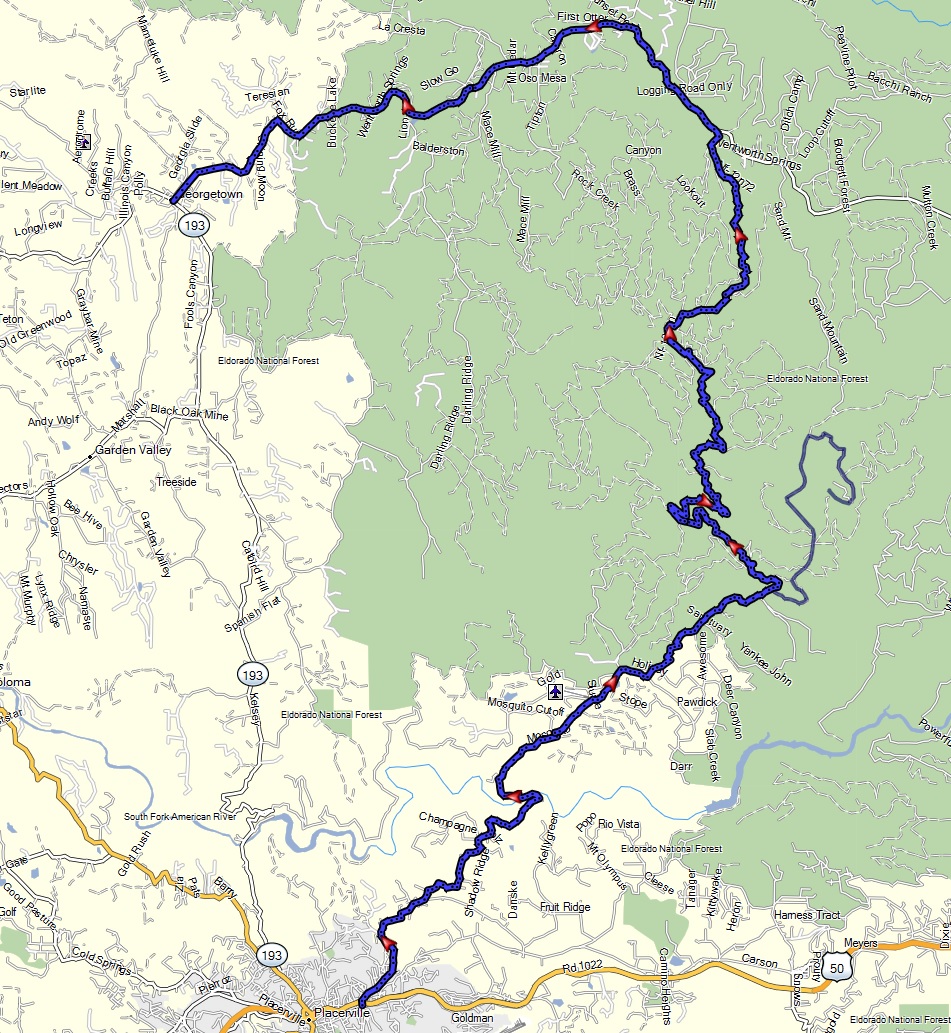 |
Placerville-MosquitoRd-Georgetown-Coloma-Folsom.gpx | Good terrain of dirt bracketed by twisty asphalt on either end. Mosquito Rd and path to Bret Harte tends to be muddy when wet. See the video here. | 3 |
| Placerville at Mosquito Rd to Georgetown, then Coloma, and ending in Folsom via back road dirt and twisty asphalt. |

|
Placerville-MosquitoRd-Georgetown-Coloma-Folsom.gpx | Good backroad dirt and asphalt twisties route. Condition tends to be good. | 2 |
| Sheet Iron route: Stonyford to Fort Bragg via Sherwood Road. |
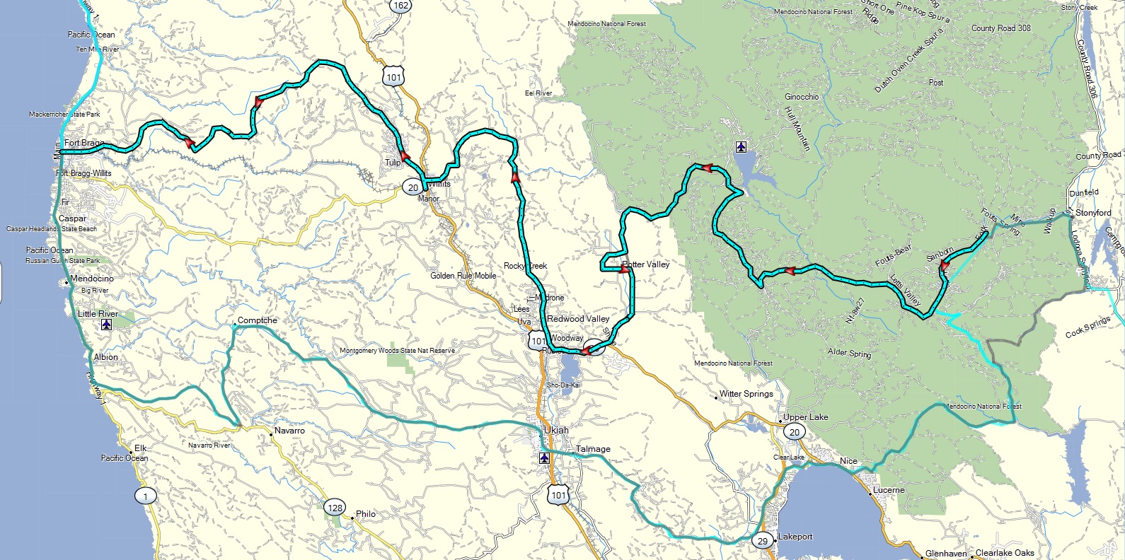 |
Stonyford to Fort Bragg SheetIron.gpx | Great dual sport ride. Mix of conditions: Rocky and rutted with some steeper hills. Sherwood road is awesome, but prone to mud when wet. Video here. | 3.5 |
| Sheet Iron return route (modified): Fort Bragg to Letts Lake at Stonyford via Clear Lake |
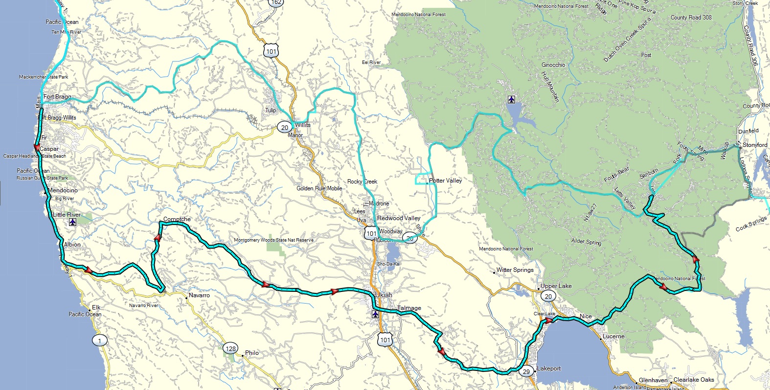 |
Fort Bragg to Letts Lake via Clear Lake SheetIron return.gpx | Mix of trail conditions, but not as technical at Sheet Iron day 1 route. Thus a bit more big bike friendly. One moderate water crossing from Bartlett Springs toward Stonyford. | 3 |
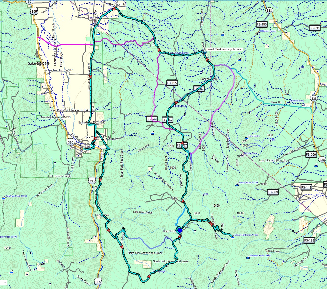
| Sweetwater Mountains: Desert Creek to Lobdell Lake |
|
Sweetwaters Desert Creek camp to Lobdell Lake and back.gpx | Rocky and rutted sections on some steep climbs plus some mud. Best done on a dual sport. See the Sweetwater mtns ride blog for details. | 3.5 |
| Sweetwater Mountains: Desert Creek single track |
 |
Sweetwaters_Desert_Creek_enduro_track.gpx | Very rugged single track with many creek crossings, sandy washes, rocky climbs, and steep descents. Best done on an enduro style bike. See the video here. | 4.5 |
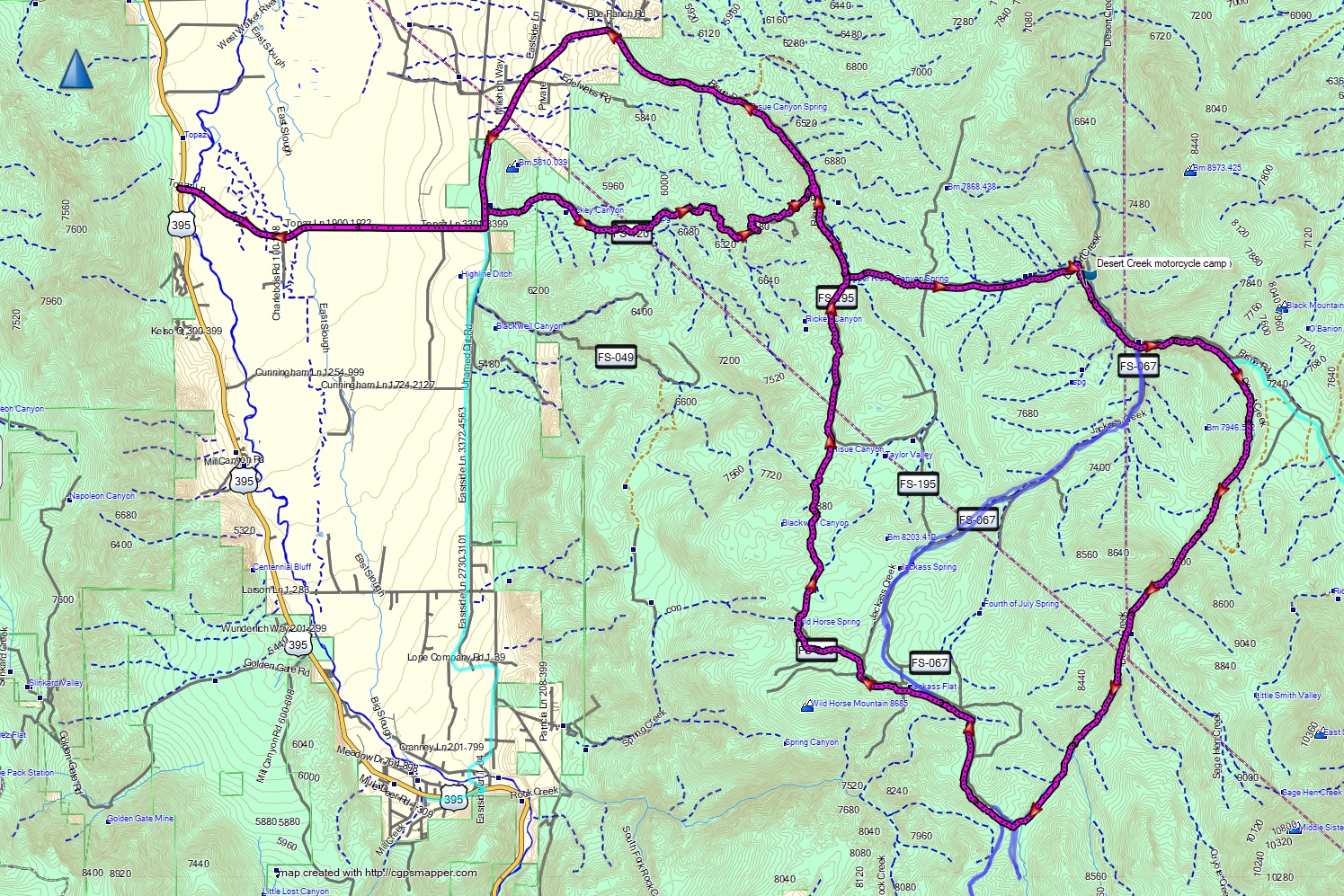
| Sweetwater Mountains: Mt. Patterson - Desert Creek - Walker loop |
 |
Mt Patterson loop from Walker 2024.gpx | Rugged double track with many rutted, rocky, and steep sections, reaching an altitude >11,650'. Best done on a dual sport. See the video here. | 4 |
| Tahoe Rim Trail east side |
|
Tahoe rim trail east dual sport.gpx | Lots of short technical sections, including steeper climbs, babyhead rocks and sand. | 4 |
| Truckee to Martis Peak and down to Kings Beach |
 |
Truckee to Tahoe via Martis Creek and peak dual sport.gpx | Mix of paved and dirt roads in reasonable condition | 3 |
| Truckee loop out to Stampede Reservoir, Verdi, and Babbits Peak |
|
Truckee Stampede Verdi BabbitsPeak loop.gpx | Big variety of conditions with steep climbs, rutted sections, loose dirt | 3.5 |
| Volcanic Tablelands out of Bishop |
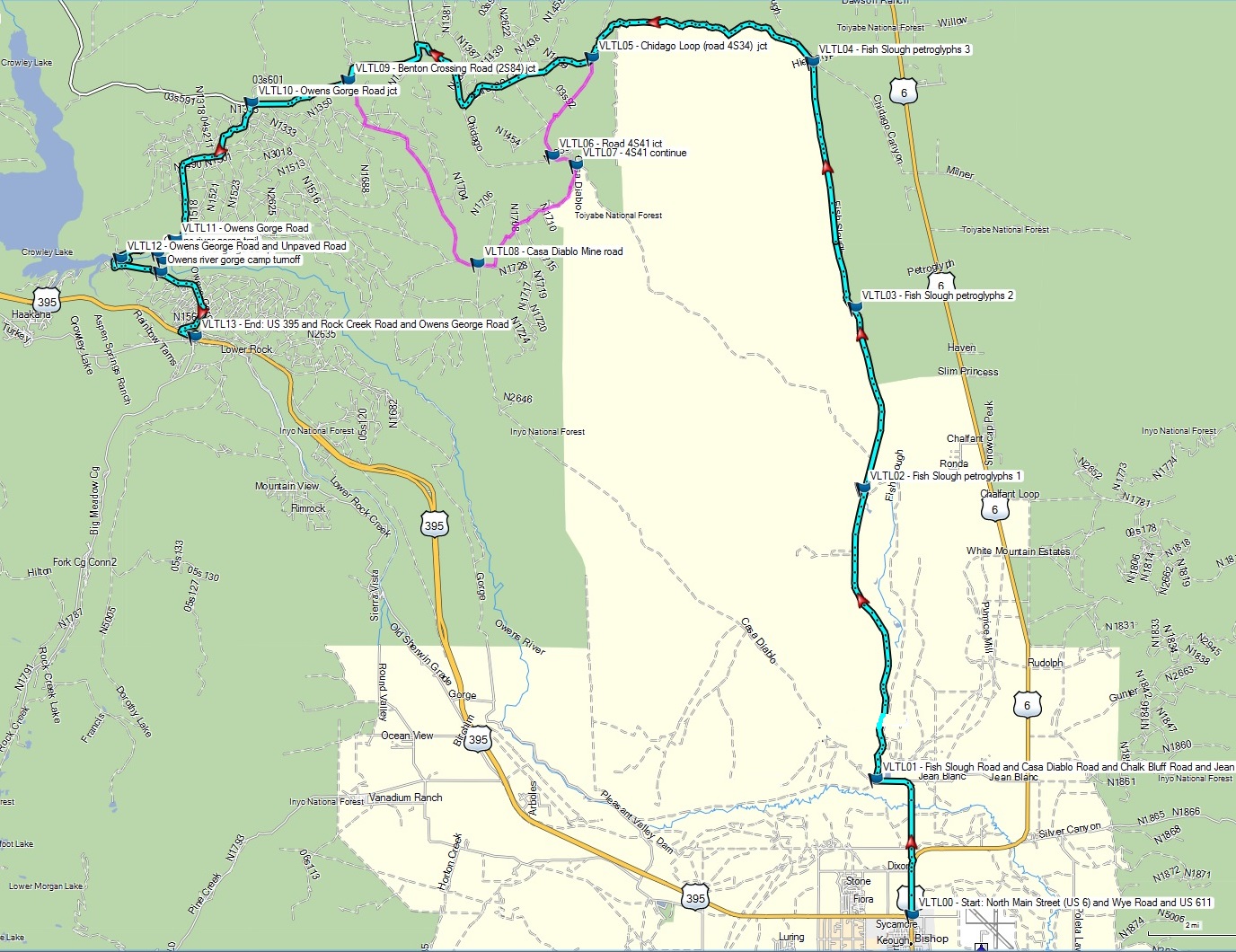 |
Volcanic tablelands dual sport track.gpx Volcanic tablelands adv bike track (easier).gpx |
Relatively maintained dirt
roads, composted mostly packed volcanic ash. See day 4 of the Eastern Sierras ride blog for details. |
2/3 |
| White Rim Trail of Canyonlands National Park, Utah |
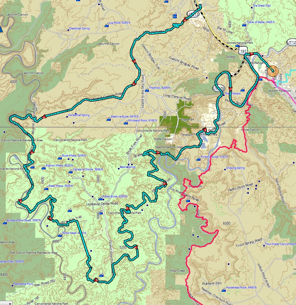 |
White_Rim_trail loop_Potash_road_Moab.gpx | One of the most scenic dual sport rides of the American Southwest. Wide mix of terrain including rocky slopes, sand, and mud when wet. Best done on a dual sport or adventure bike with skills. Permit required. Video here. | 3.5 |
| Yerington - Bodie |
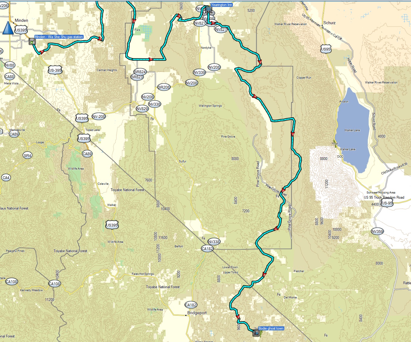 |
Minden to
Yerington 2024.gpx Yerington to Bodie 2024.gpx |
Lots of rocky and sandy sections in remote
locations that will
challenge your desert riding skills. |
3.5 |